


Corps of Engineers seeks input from residents, recreationists
By Scott Swanson
Of The New Era/Lebanon Local
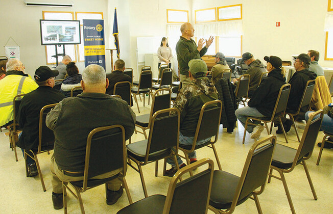
U.S. Army Corps of Engineers officials have begun the process of writing a master plan for Foster and Green Peter reservoirs and at a meeting held in Sweet Home Saturday morning, Feb. 25, they said they want input from local residents and users of the lake.
At the meeting, hosted by the Corps at the Community Center, various USACE officials laid out the parameters for the plan, which will dictate many aspects of how the agency manages the South Santiam River watershed.
Although Corps officials acknowledge that it is time to update the master plan for the watershed – the last one was completed in 1987 – they are also responding to a federal judge’s ruling in response to a lawsuit filed by environmentalists who argued that the Corps should be more transparent about its dam operations and their impacts on salmon and steelhead smolts heading out to sea.
U.S. District Judge Marco Hernandez in the fall of 2020 ordered the Corps to make changes at its dams in the Willamette Basin so that juvenile salmon and steelhead could pass through them more easily.
The fish are listed under the Endangered Species Act and, according to environmentalists, dams on the Willamette River have blocked access to spawning grounds, which has contributed to population declines.
Hernandez’s injunction has required the Corps to change its dam operations in numerous ways to improve fish migration and water quality in four tributaries of the Willamette River, including the South Santiam River.
The Corps is working toward a deep drawdown at Green Peter over the winter months and a significant reduction in electrical power generation at the dam to enable young smolts to get over the dam on their way to the ocean.

Deep drawdowns require the Corps to lower the elevation of the reservoirs to within 25 feet or less of the dams’ regulating outlets, prioritizing water flow over the top of the dam rather than through hydropower turbines, especially during the night when fish have higher rates of migration. The planned drawdown at Green Peter would lower the water level to the point that none of the existing boat ramps would permit access to the lake.
Corps officials are already putting together a Programmatic Environmental Impact Statement that will reshape the management of the 13 reservoirs in the Willamette Basin operated by USACE. A draft version of that plan was unveiled in January, when public hearings on it were held in Sweet Home and other communities throughout the region.
This master plan will be more specific to the local region than the draft Programmatic Environmental Impact Statement (EIS) currently being written, which the Corps took testimony on in a series of public meetings in January, said Wendy Jones, environmental stewardship supervisor for the Corps’ Portland District.
“The Environmental Impact Statement, is for the entire system, all 13 dams,” Jones told a crowd of more than two dozen people, who included Sweet Home Mayor Susan Coleman, City Manager Kelcey Young and County Commissioner Will Tucker, along with local residents and others with interests in the lakes.

Greg Taylor, a fisheries biologist who’s worked for the Corps for 22 years, discussed the reasons why the dams exist in the first place. He said he’d reviewed testimony from local residents from 70 years ago, when similar meetings were held prior to the construction of the dams, in which residents voiced concerns about flooding and safety.
“It grounds you when you go back to some of that testimony,” Taylor said. “It really paints a picture for why the dams got put in place.
“These dams, at the end of the day, went in because the public wanted to do something about that.”
He said the main concerns voiced in those meetings was flooding, but the dams also provided hydropower, municipal water supplies, recreation, and fish and wildlife management.
“All those purposes, you know, are part of the stewardship that we do to manage this resource,” Taylor said, adding that “they don’t always play nicely together. Right? Sometimes they do. But you can imagine how we have to try to strike a balance on all these different things that we do. We can’t manage a flood if there’s no storage space in there to manage the flood.”
He noted that during draw-downs “you can still get on that body water and recreate, but it’s not ideal. There’s some tension there between those two and we work to balance those things.”
Jones outlined the steps involved in creating the master plan.
“The master plans get too narrowly focus on each watershed,” she said, noting that this is the second of six such plans to be undertaken by the Corps. The first, which was begun last year, is focusing on the Coast Fork of the Willamette River, which comprises Cottage Grove and Dorena lakes.
“The master plan for this area will just be for Foster and Green Peter lakes. It allows us to focus on what we’re going to be doing.”

The plan, which is scheduled to be adopted in September of 2024, is a “strategic” land use document that will guide the comprehensive management and development of all recreational, natural and cultural resources throughout the lives of the dams, Jones said.
It will address strategies for protecting and managing all the resources within the South Santiam watershed, including recreation, interpretation, fish and wildlife, cultural resources, vegetation, water and wetlands, and mineral resources.
Jones said that, in preparation for putting this plan together, Corps officials have already met with representatives of other agencies, including Linn County Parks – which manages campgrounds, boat ramps and other facilities surrounding the lakes – the Oregon Department of Fish and Wildlife, the U.S. Forest Service and Bureau of Land Management, and more.
“We talked with them about what their current goals are and what their future goals are.”
Jones said the 1987 master plan for the South Santiam watershed classifies “all the lands” within the Corps’ boundaries, and classifies resources such as wildlife habitat, vegetation management areas and recreational areas.
“So then when we go through our updated plan and hear from the public, and we see how people want to use these areas, we would redo classifications if we need to change boundaries, split units and do those sorts of things,” Jones said.
“You could add a new wake area if you’re trying to protect docks or infrastructure, or fish and wildlife sanctuaries,” she added, as an example.
The master plan does not address some of the dams’ functions, she said.
“This may frustrate some of you, but the master plan does not go into detail about the dam operations, the lake elevations, the water quality parameters, the fish passage requirements,” she said, adding that such “operations” issues are addressed in the EIS.
“Master plans are ‘How do you manage the landscape? How do you manage the recreation? How do you manage those resources?'”
The documents are related, she said, but “the master plan has to respond to and react to all of the dam operations.”
She said that changes in land use, environmental conditions, regulations and how people recreate all necessitate an updated plan.
“Larger RVs, that means you need more water,” Jones said. “When they’re camping in a campground, we need pump-out stations. There’s larger boats, so the boat ramps need to accommodate that. There’s more paddle sports access. You don’t want them launching from the same boat ramps that power boats are launching from.
“All those changes are a good reason to update our master plans and keep them relevant.”
Another focus of the plan, she said, is “cultural resource stewardship.”
“We’re more aware of what our responsibilities are around cultural resource protection and management,” Jones said, adding that added staff has helped the Corps become more active in that area. She noted that such archaeological sites can be homesteads that were covered by the lakes when the dams were built, as well as Native American artifacts and gathering areas.
“We’re working quite a bit more with the tribes to really fully understand and implement our trust responsibilities,” she said. “And another thing that is important too, is that when you have the lake lower like this, you’ve got a lot of exposed archaeological and historic sites. And so we have an obligation to prevent looting those sites as well.”

Christie Johnson, natural resource specialist for the Willamette Valley and a longtime Corps ranger in the area, reviewed some of the Corps’ efforts and cooperation with other agencies to monitor the natural and cultural resources in the area, particularly for damage and looting.
“We check our boundaries and make sure that nobody’s encroaching or trespassing,” she said, adding that it’s “an important mission for us to protect and preserve archaeological sites and artifacts, historic building resources” that remain from when the dams were built.
Jones and others emphasized that they want to hear from community members regarding expectations and concerns.”
“What we’re really talking about is how do we still effectively manage the systems and then make sure we can respond to that,” Jones said. “This community has had a lot of change from these dams.
“Some of you or some of your parents have worked on the dam construction crews. Some of you have been forced to move, or your relatives were forced to move when the dams were built. Your fishing and hunting access areas changed when the dams were put in.”
“What we’re hoping with our master plan revisions is that we can look at these changes coming with this fish passage and try to work with you. We all want the most positive outcome that we can have. We can’t change a lot of these conditions, but we can try to work with you and talk with you and listen to you about what you want to see.”
Johnson reviewed the specifics of many of the recreational facilities, including Sunnyside and Whitcomb Creek campgrounds, which together number more than 200 campsites, which are operated by the county on Corps property.
“People travel from all over Oregon and probably even outside Oregon to visit Foster Lake,” she said, adding that not only are the facilities popular with outsiders, they are heavily used by locals.
“They’re really important for recreation, and bringing revenue to us as well,” she said.

Following the presentation, Corps staff members conducted breakout sessions to allow audience members, who didn’t speak during the meeting, to provide input.
Members of the public are encouraged to weigh in by March 24 with concerns and ideas by visiting http://www.FGPL-MasterPlan.com, emailing [email protected] or mailing thoughts to AGEISS Inc., 1401 Marvin Road, Suite 307 #517, Lacey, WA 98516.
As the master plan nears completion, further public meetings will be held, likely in early 2024, Jones said.